
The government has settled on the final path for the Naivasha route of the Standard Gauge Railway, but it still cuts through the middle of the Nairobi National Park.
The new path has a viaduct that cuts through the middle of the park for six kilometres, dividing it into two almost equal portions.
The railway line will be carried on pillars rising eight metres at the entrance into the park and tallest at 41 metres at the exit of the park.
This design contradicts assurances from the government and Kenya Wildlife Service that the endangered park would be spared.
Conservation groups have already opposed the new path and demand that the government takes the railway completely out of the tiny park.
But the KWS board of trustees have reportedly already accepted this new design, according to a meeting between representatives from the Conservation Alliance of Kenya and those from the involved government departments.
President Uhuru Kenyatta is now expected to launch the Nairobi-Naivasha leg of the SGR on September 26 this year.
Environment PS Margaret Mwakima, her Transport counterpart Irungu Nyakera and Kenya Railways Corporation Atanas Maina met the alliance members last week in Nairobi and announced the new development.
“The government is committed to ensure that these developments do not compromise the natural resources for current and future generation, but a trade-off for the interest of the Kenyan people must be made,” said Irungu.
They also announced that an Environmental Impact Assessment will only be carried out after Uhuru launches the project next month.
The alliance now wants the presidential launch postponed until an EIA is done.
“A presidential launch of the project before EIA process has been concluded could highly compromise the EIA process and the decision thereof. It’s unlikely that Nema will deny Kenya Railways an EIA licence for a project who’s the President has launched,” says Julius Kamau, the executive director of the East African Wildlife Society.
The meeting was also attended by representatives from the United Nations Environment Programme, Conservation Alliance of Kenya, Friends of Nairobi National Park, International Fund for Animal Welfare and the International Union for Conservation of Nature.
KWS, WildlifeDirect and WWF skipped the meeting.
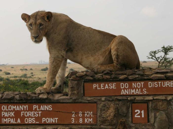
Nairobi National Park covers just 12,000 hectares and is the world’s only national park within a city.But its future now is uncertain as it is currently being assaulted by different government-sponsored projects.
In 2013, the park lost 60 hectares from its northern edge to make way for a new ring road.
The Mombasa-Nairobi leg of the railway will also pass through the park.
The park is further surrounded by built-up areas that have sealed nearly all animal migratory routes.
The ministry of environmernt defends the new Naivasha route saying they considered seven options after nine months of negotiations with the Ministry of Transport and KWS.
The design will include deflectors to reduce the impact of noise pollution, the designs show.
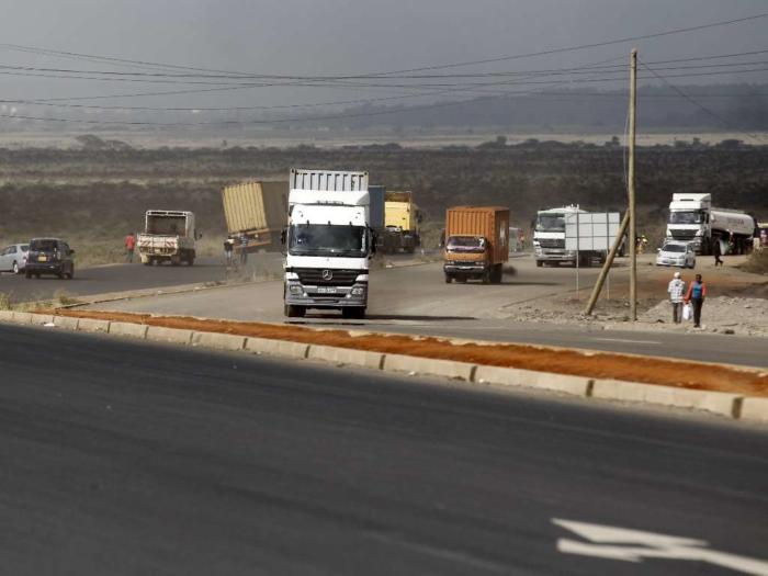
KR boss Atanas Maina defended the construction saying currently, cargo traffic through the port of Mombasa currently stands at 27 million tonnes per year, but only 5 per cent is transported using railway.
“It is expected that the SGR, upon completion, will be able to handle up to 16 million tonnes of cargo per year, with additional capacity being availed once the railway is electrified,” he said at the meeting.
Syokimau is the intended termination point of the Mombasa-Nairobi route (Phase 1), and beginning of phase 2A route (Nairobi-Naivasha). It will consist of passenger terminus, cargo terminus and handling facilities, a marshalling yard and workshops set on 400 acres of Kenya Railways land.
The entire Nairobi-Naivasha route will cost US $ 1.483 billion and a commercial contract with China Communications and Construction Company has been signed for the construction of this phase, secured through a financial facility with the Chinese EXIM bank.
The project will run for four years and five months with a 4.9 km tunnel at Ngong Hills taking much of the construction time.
Here are the seven options that the government considered (Source: Vote To Save Nairobi National Park)
Option 1: Kibera Route (orange line)
Routing along the Southern bypass and cutting through Kibera and terminating close to the inland container depot. Required an underground tunnel after carnivore and a bridge before the Ngong forest. Required land acquisition at Sh120 million.
Estimated cost of construction: $674 million
Option 2: Langata Forest Magadi Road Route (yellow line – not easily visible on map)
Along southern bypass with a dog leg through the western forest in NNP then exit through Magadi road. Challenge that it would pass through several institutions incurring huge land costs.
Estimated cost of construction: $615 million
Option 3: Savannah Route (red line)
Savannah route through the middle of the park from the Syokimau to near the Maasai gate/Tuala. Built on an overhead bridge 7.2km long, 18m high across length of park.
Estimated cost of construction: $523 million
Option 4: Modified Savannah Route (light blue line)
Similar to the option above but slightly shorter with a variation in the southern section. Built on an overhead bridge 6.0km long, 18m high across length of park.
According to CAK This is the option KRC proposed to proceed with.
Estimated cost of construction: $543 million
Option 5: Upper South East Route (dark green line)
The track starts at Mlolongo and exits south.
Estimated cost of construction: $611 million
Additional annual cost of operation compared to other proposed routes: $3.55 million
Option 6: Lower South East Route (dark blue line)
Similar to above but starts lower down along Mlolongo and exits south.
Estimated cost of construction: $635 million
Additional annual cost of operation compared to other proposed routes: $3.55 million
Option 7: Athi River Route (pink line)
Athi river route follows the same route as Phase 1 of SGR, which has already taken park land. Athi river route requires significant modification from the Syokimau hub to operate. Requires parallel 2.5km bridge at Athi River. Still needs additional park land – 100 acres. KRC did not prefer this route as it would require double tracks to the marshalling yard.
Estimated cost of construction: $832 million
Additional annual cost of operation compared to other proposed routes: $12.34 million.
Source : The Star
")


